Historically, people have used maps or devices centered on GPS as their guides, from metropolitan cities to complicated indoor environments. Here comes augmented reality navigation, the most recent wave of digital innovation coupled with real-world spatial awareness, which claims to define levels of precision, access, and user engagement.
Placing dynamic directional cues across live environments, it dissects limitations and provides an intuitive context-aware wayfinding system. This article explains the working principles, applications, and revolutionary potential of augmented reality navigation.
What Is Augmented Reality Navigation?
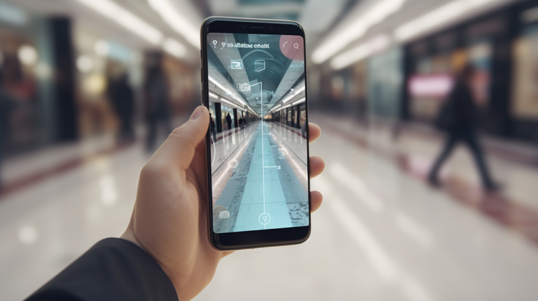
Augmented Reality Navigation (AR Navigation) refers to those systems that overlay some digital information, whether directional arrows, points of interest (POIs), or contextual data, over the user’s view of their real-world surroundings in real time.
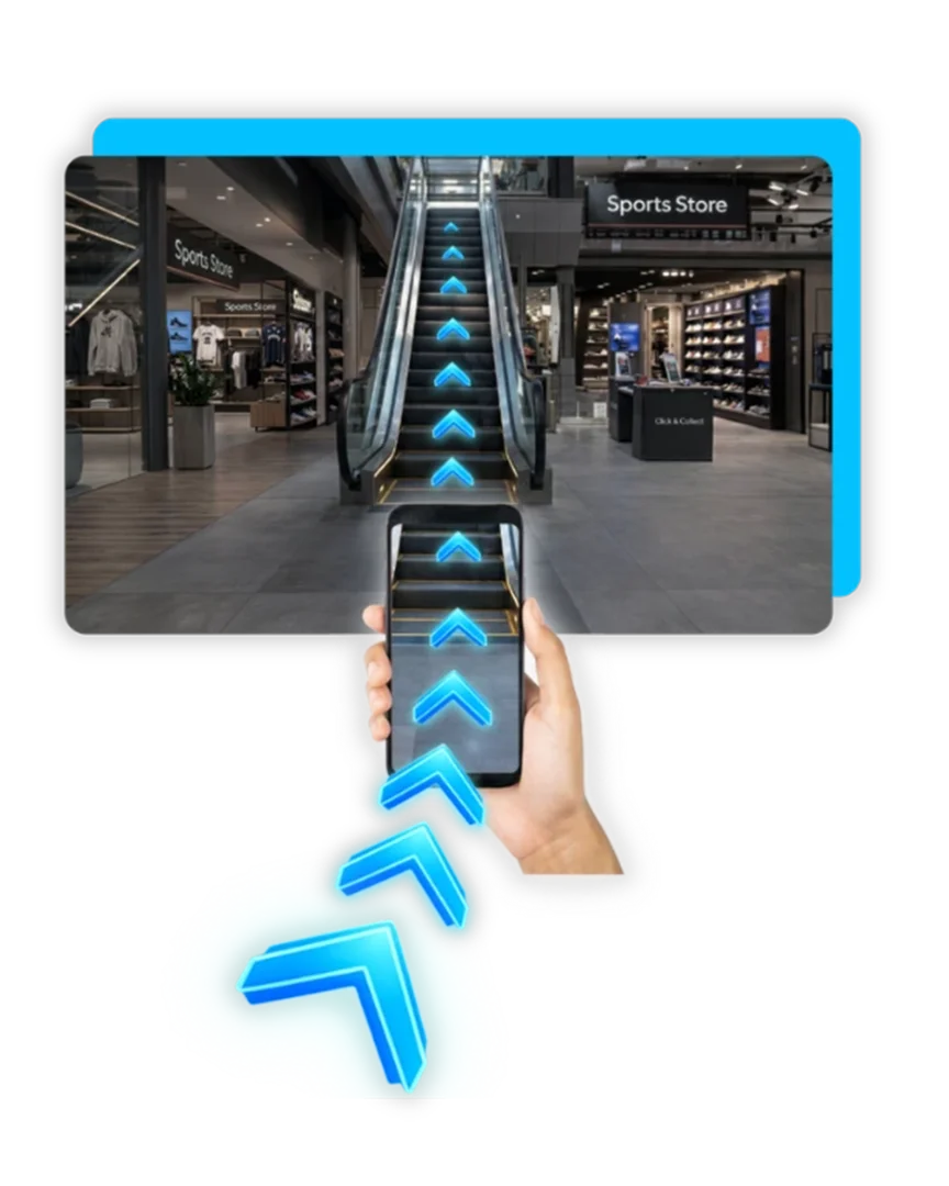
Unlike static 2D maps, AR navigational interfaces require that these navigational elements be plastered directly onto the environment viewed through smartphones, tablets, or AR headsets. For instance, a user navigating a shopping complex may see virtual signage floating over the store entrances or even a path that somehow guides them to an escalator.
The technology makes use of a theory called augmented reality, which actually integrates computer vision with some sensor data and geospatial tracking so that the digital content is aligned with real-world objects. Algorithms compute from a combination of inputs from cameras, LiDAR, and inertial measurement units (IMUs) to perceive spatial geometry, track user movements, and place stable and accurate overlays.
Technical Foundations of AR Navigation Systems
The efficacy of augmented reality navigation hinges on the integration of multiple technologies:
- Computer Vision: Cameras and depth sensors capture environmental data, identifying surfaces, objects, and spatial boundaries to anchor digital content.
- Sensor Fusion: IMUs (accelerometers, gyroscopes, and magnetometers) track device orientation and movement as overlays remain aligned and viewed through a perspective of the user.
- Precision Localization: For indoor navigation, where GPS signals do not work well, a site within a few centimeters finds a user’s location using Bluetooth Low Energy (BLE) beacons, Wi-Fi fingerprinting, or Ultra-Wideband (UWB).
- Simultaneous Localization and Mapping (SLAM): This algorithm usually allows the devices to map unknown environments in real time, along with tracking the position of a user within such spaces.
These combine to make augmented reality navigation systems deliver highly accurate, real-time guidance associated with the immediate user context.
Indoor Navigation: The Pinnacle of AR Utility
AR truly turns out most of its value indoors, and not outdoors, in augmented navigation. Traditional GPS breaks down inside a building, where signals coming in are blocked by walls and roofs; at the same time, augmented reality excels by utilizing the built-in infrastructure that is already set up within a particular site. Some of the fundamental applications include
- Healthcare Institutions: Patients illustrate indoor navigation systems installed in hospitals that lead them to clinics, pharmacies, or diagnostic centers so that waiting time is reduced and visits are more pleasant.
- Retail and Hospitality: Augmented reality wayfinding guides shoppers toward stores, promotions, or amenities within a mall, betting on customers’ engagement and satisfaction.
- Industrial Complexes: Warehouse managers implement AR markers to improve inventory management.
- Cultural Institutions: Museums now have tours that are augmented by using AR because history can be placed on top of them, thus becoming more educational, as with multimedia content, on an exhibit.
It transforms confusing layouts into clear visual guides; thus, augmented reality navigation minimizes disorientation while maximizing efficiency within closed spaces.
Advantages Over Conventional Navigation Solutions
AR-driven systems offer distinct benefits compared to traditional map-based tools:
- Contextual Precision: Instead of providing some abstract instruction like Turn left in 100 meters, AR gives a visible cue to turn at the appropriate moment, such as a glowing arrow at the intersection of a hallway.
- Reduced Cognitive Load: Visual overlays suffice for aiding human perception and minimizing the interpretation of any symbols or text.
- Hands-Free Operation: Projection of navigation data into the field of view using AR headsets is ideal, as a user cannot interact with the device due to the nature of such a setting (e.g., construction sites).
Clearly, these advantages are really impactful in indoor navigation, as they tend to overcome challenges in orientation and spatial awareness that have persisted over time.
Current Challenges and Considerations
Despite being an attractive proposition, certain challenges exist for the acceptance of the more widespread AR Navigation:
- Costly hardware (advanced processors/sensors)
- Batteries drain very fast due to the constant use of sensors/cameras.
- Privacy concerns with indoor mapping data.
- Inconsistencies of calibration in the dynamic environment (for example, in retail).
Edge computing, 5G, and AI advancements will attempt to solve these limitations.
Augmented Reality Navigation provides a paradigm shift in spatial interaction, bringing the immediacy of the physical world and flexibility of the digital interface into unity. The potential to render indoor navigation easier, along with utility in the realms of healthcare, retail, and industrial sectors, lends it merit as a cornerstone in modern wayfinding.
Although technical and ethical challenges remain, innovation will eventually lead to exorbitant efficiency, safety, and user engagement. AR solutions will be widely adopted by industries and consumers alike, and that will soon blur the line between digital guidance and real-world exploration.